Pärnu and an Estonian Leisurely Stroll #DAYS 19-20
Day 19
Friday September 29th
Friday morning marked our final morning in Tartu. Sacha and Vicky were set the task of producing breakfast out of anything and everything that was left. This was a resounding success, fuelling everyone with cheese toasties ready to catch the bus to Pärnu at 1030. 2 hours and 50mins later we arrived in Pärnu. Mailiis and Reelika met us at the bus station to ferry our rucksacks to where we were going to be staying. Amy W and Sacha were allocated to Reelika (and her dog!), Amy B and Roxy were staying with a friend of Reelika around the corner, and Lauren and Vicky had a flat to themselves a couple of blocks away.
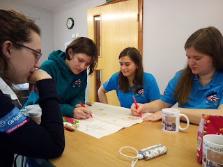
After a quick stop to drop off bags we were whisked to lunch by Mailiis, who treated us all to creamy salmon pasta (Sacha and Vicky), and fried cheese and chips (everyone else). Suitably stuffed with food, it was back on the bus again to meet some of Reelika's Guides for a discussion about the Rover programme. We spent an enjoyable hour collecting activity ideas from the girls, as well as sharing some games and songs with each other.

We were then whisked back to Pärnu town centre by Martina, who gave us a guided tour. We arrived at the beach in perfect timing to see the sun setting over the bay. Spontaneous paddling and gymnastics ensued. We then wandered back through the park to what was described to us as being the best pizza restaurant in the whole of Estonia! Martina left us to enjoy a delicious meal of various pizza flavours, as well as some very reasonably priced wine. After a busy day of sightseeing (and a lot of food) we all departed for our various flats, ready for an early night in preparation for the next day's hike...


Day 20
Saturday September 30th
Saturday September 30th
The Day of the Great Hike. By Vicky Bennett age 24 1/2.
The day of the 25km hiking game dawned grey and cold. Typical luck considering the amazing sunshine we had been enjoying up until that point. Roxy and Amy B were woken by a breakfast of porridge and raspberries, various rye breads, a selection of cheese, tomatoes, miscellaneous meats, and mint tea. To quote Amy B "I couldn't have felt more Estonian if I tried".

The vague instructions we had all been given were to be outside the flats at 0830, where cars would arrive to take us to the hike. Eventually said cars did arrive, driven by some of Reelika's friends we didn't know, and we set off on the 40km drive to the start point.
The start point seemed to be the equivalent of a village hall. We posed for some pre-hike photos, and were given the instructions for the hike. We were given the first coordinates to begin with, and on reaching these we would have to complete a challenge to receive the next point. Eventually we would finish back at the start again. Our staggered start time was not until 1040, so the five of us doing the hike started to plan our route to the first checkpoint, and as Lauren had decided not to do the hike, she set off to man one of the checkpoints.


NB: A side note here about navigation.
Let me take this opportunity to discuss the flaws of the map we were provided with. (Sacha says I should say "differences" rather than flaws.) I have never had such an appreciation for Ordnance Survey as I do now. Firstly, a 1:50000 scale is not ideal. Manageable, but not ideal. Although as OS maps are produced at a 1:50000 scale I suppose I'll let them off. Secondly, there was no legend provided with the map. We could have coped with this, however Estonian maps seem to show all their features differently to OS maps... For example, we still don't know what the small black triangles dotted all over fields meant. It was also confusing that the Estonian symbol for "sand" is the same as OS use for "marsh". Two very different things. We also struggled with rights of way. The mixture of green crossed lines, black dashed lines, and black solid lines left us none the wiser when confronted with tracks that were not on the map but definitely existed in real life, and vice versa. Thirdly, Estonia is flat. Very flat. Not actually the fault of the map, but lack of contours does not aid navigation. I hope that this helps explain our difficulties later in the day. But I digress...
So. Checkpoint 1 done. Next up, checkpoint 2. We tramped through a load of trees to some drainage ditches whereupon we encountered that most foul of creatures: the moose fly. Picture a normal fly. Now imagine it is brown. Now imagine that is is sticky, and enjoys burrowing itself into your clothes, hair, and bum (more on that later). Due to the sticky nature of the moose fly, you have to prise it from your skin, then wildly flap your hand in the air shouting obscenities in order to remove it from yourself. We spent hours of fun experiencing these wonderful creatures in their natural habitat*. Moving away from the drainage ditches, we found a decent path and powered on to checkpoint 2. This was an unmanned checkpoint, so we were able to simply write down the next coordinates. Checkpoint 2 complete.
Moving on along the path to checkpoint 3, we were able to ponder the curious nature of Estonian agriculture. Three main questions arose from this discussion; 1. Where are all the cows? (We had literally seen no cows up until this point). 2. Why are there so many abandoned boarded up concrete buildings? (Very eerie to walk past these when on your own in the middle of nowhere). 3. Why is everything made of wood? (Literally everything. When was the last time you saw a non-metallic grain silo? We saw one yesterday. How about wooden scaffolding? Or whole entire houses made of wood? Fascinating stuff).
On arrival at checkpoint 3, we were presented with another challenge to complete. There was some initial difficulty with the language barrier, but then this guy appeared to translate, who took great delight in telling us about his time living in Swansea. Resisting the urge to apologise for the fact that he had had to spend any time living in Swansea, we listened to the challenge instructions, and selected Sacha, Amy W, and Amy B to take part in the Kim's game. They devised a strategy, and successfully remembered 19/20 items. Although as they pointed out, the several "metal-things-with-wooden-handles" were not the easiest of objects to identify. Challenge 3 completed, coordinates received, we moved 500m up the road to checkpoint 4.
Checkpoint 4 was an obstacle course challenge. We had to carry a log through some tyres, under a net, up a hill, and then run back. We enthusiastically completed the task, while timed by an Estonian man in camouflage, wearing a large dagger on his belt. With a shrug he declared that our time was "average" and gave us the next coordinates. His enthusiastic motivational words spurred us on and we made it to checkpoint 5 with no issues**.


Philosophers have long pondered the question "when is a stream not a stream?" Turns out that a stream is not a stream when it hasn't rained for 2 weeks and it's gone dry. Therefore our simple journey to checkpoint 5 was made not so simple. We set off from checkpoint 4 with the plan to follow the track to a significant left turn, and if we crossed a stream we had gone too far. We encountered a left turn, but it did not look as significant as we had imagined (see note above on the map we had been given. Grrrr), so we carried on. After another 10 mins we realised we had gone way too far and had obviously passed the non-existent stream, so turned back down the "path" we should have taken. It was at this point we were overtaken by 2 teams in quick succession. But we did find checkpoint 5 - another unmanned one - and wrote down the next coordinates.
By now we were getting pretty hungry. The next checkpoint on the map (checkpoint 6) looked like it might be at a church. We utilised our keen skills of deduction and decided that this must be where lunch would be served from. Spurred on by the thought of food, we pushed on along 3km of road, and sure enough were greeted by the sight of food.
Lunch was pasta, pork mince, carrots, gherkins, and tomato ketchup. An unusual but surprisingly tasty combination. It was whilst sat down eating that the first bum-related incident of the trip occurred. I was suddenly aware of a tickling sensation down the back of my trousers. I therefore very calmly removed the offending moose fly from my pants and carried on eating as if nothing had happened***. Food finished and bum-related incident number one recorded, we continued to checkpoint 7.


We set off along a gravel track/road/path (again I refer you to my earlier point concerning rights of way), closely followed by another team. It was at this point that we decided we needed a toilet stop, but unfortunately open ground whilst being followed by 3 men and a dog is not ideal for this. We therefore detoured into a small wooded area and let them pass us. 5 mins after setting off again, Amy B suffered the second bum-related incident of the day. She realised she had now got half a forest in her pants, so ran off to remove it before we carried on. Shortly afterwards, we stumbled on the unmanned checkpoint 7 by pure chance. We now realised that although this was good, we didn't actually know where we were or how to get to the next one. Whilst studying the map, 2 other teams arrived and we helpfully pointed out the hidden checkpoint. Unfortunately they did not return the favour and show us where we were, and strode off leaving us as confused as ever.
We spent the next hour or so wandering around various tracks, including walking backwards and forwards past the same farmer 3 times. He found it hilarious and waved each time. Miraculously we found checkpoint 8, a challenge manned by Lauren! She explained the task of building a tower and we successfully completed it. She then cheerfully informed us that we were the last team. Cheers mate . Not put off by this, we set off again towards checkpoint 9.


Checkpoint 9 was easy to find as it was right next to the sea, and as we approached we saw a rowing boat in the water. The team of girls in front of us advised stripping down to our pants as we would get very wet. (It was unclear if this was friendly advice or if they just wanted a laugh at the British girls' expense). Amy B and I were selected based on our respective skills. Amy B rows for her university college so was an obvious choice, and as for myself I had been in a rowing boat once. On holiday. Several years ago. And more importantly I was prepared to get wet. We resisted the urge to strip to our underwear in front of strangers, and completed the challenge with no fear of the damp repurcussions. We therefore impressed the checkpoint staff with our rowing skill (I'm assuming they were impressed, they just looked cold and bored by this point) and were given the next coordinates for checkpoint 10.


After this point our hike went downhill. (Not literally downhill; there were a total of 2 contour lines on our entire map). We were tired and hungry, so decided to ask for some navigation advice. A man with almost perfect English was happy to help and advised us to follow a stream to get to the next point. Easy. Or so we thought. We reached said stream. On either side were thick bushes, impossible to follow along or cross. We therefore decided to walk around and take an alternative path, which would unfortunately add several km to the journey. It was beginning to get dark, but we only had 2 checkpoints left so were keen to press on.
Headtorches in place, we reached the alternative path, which appeared to go directly through a garden. A man appeared from the house, and in my best impression of a lost British tourist I waved a map in his face and shouted loudly and slowly:
"IS THIS A PATH? WE NEED TO WALK TO HERE" *points to checkpoint on map*.
"Dear me chaps would you mind awfully turning off your torches? The light is shining right at me and it's awfully hard to see anything" he replied in impeccable English****. Or words to that effect. He then told us the path was too overgrown to follow, and our best bet was to return to the stream and follow it, as was the original plan.
"But wait!" I cried***** "Surely the sides of the stream are too overgrown? We can't force our way through the bushes!"
"No, you must walk IN the stream. It's mostly dry and it's really easy to walk down."
We gazed disbelievingly at eachother. Of course we should have walked along the stream. How obvious now it had been spelled out. And how depressing that we had walked so far to the path needlessly. We turned and wandered back into the darkness. At this point, Sacha's phone rang. The hike coordinators had decided we had taken too long and were cutting us off. We needed to go back to the centre. Luckily, we were only about 2km from the start/finish at this point, but it was absolutely gutting not to complete the hike.
When we all looked at various fitness trackers later, we realised we had actually walked about 30km due to getting lost so much. So at least we had managed a 25km route, if not the right one. And at least we provided some amusement to the Estonians who no doubt will have some great stories to tell: "Did you hear about the British girls? Couldn't even read a map! And didn't realise they were supposed to walk IN the stream! Although I hear they looked great in headtorches..."
Despite the final disappointment, all in all an amazing day, and we managed to remain cheerful to the end.
Stats:
Kilometres walked: 32km. (At least)
Deers seen galloping through fields in the sunset: 1
Bum-related incidents: 2
Moose flies destroyed: not enough
Elks licked: 0
Kilometres walked: 32km. (At least)
Deers seen galloping through fields in the sunset: 1
Bum-related incidents: 2
Moose flies destroyed: not enough
Elks licked: 0
*This is a lie.
**This is also a lie.
***Yet more lies.
****Actually not a lie. Although a slight exaggeration for dramatic effect. Clearly no one would ever say "dear me chaps".
*****More dramatic effect
**This is also a lie.
***Yet more lies.
****Actually not a lie. Although a slight exaggeration for dramatic effect. Clearly no one would ever say "dear me chaps".
*****More dramatic effect


Comments
Post a Comment